TIEBitmapHelper.GenerateMap
Declaration
procedure TIEBitmapHelper.GenerateMap(Width, Height: Integer; Latitude, Longitude: double; MapZoom: Integer = 14; MapProvider: TIESlippyMapProvider = iesmpOSM_Mapnik;DrawPin: Boolean = True; PinSize: Integer = 40; PinColor: TColor = clRed; const MapCachePath: string = ''; MapApiKey: string = '');
Description
Uses the TIESlippyMap class to download and render a map using OpenStreetMap data.For more detail: wiki.openstreetmap.org/wiki/Slippy_Map
| Parameter | Description |
|---|---|
| Width, Height | The size to create the map image |
| Latitude | The latitude in decimal degrees (for the center of the image). For the latitude of the image use EXIF_GPSLatitude |
| Longitude | The longitude in decimal degrees (for the center of the image). For the longitude of the image use EXIF_GPSLongitude |
| MapZoom | Specifies the zoom level (0-...). Level 0 is the minimum zoom (supported by all map providers) which is the most zoomed out (country level). Maximum zoom is map provider specific, but high values, e.g. 18, are most zoomed in (street level). See TIESlippyMapProvider for maximum value for each map provider. |
| MapProvider | Specifies a Predefined map provider |
| DrawPin | If enabled, a pin is drawn at the center of the image |
| PinSize | The size of the pin in pixels |
| PinColor | The fill color of the pin |
| MapCachePath | If specified, maps are saved to the specified path to speed up reuse |
| MapApiKey | Specifies the user key for map providers that requires registration |
Note:
◼You must add the iexHelperFunctions unit to your uses clause
◼Delphi/C++ 2005 or newer is required to use helper classes
◼If attached to a TImageEnView, it will automatically call Update
Demos
 | Demos\ImageEditing\EveryMethod\EveryMethod.dpr |
Examples
Also see: Automated Samples
// Generate a map showing the location of the current imageIf ( ImageEnView1.IO.Params.EXIF_HasEXIFData ) and
( ImageEnView1.IO.Params.EXIF_GPSLatitude_Str <> '' ) and
( ImageEnView1.IO.Params.EXIF_GPSLongitude_Str <> '' ) then
ImageEnView2.IEBitmap.GenerateMap( 500, 500, ImageEnView1.IO.Params.EXIF_GPSLatitude, ImageEnView1.IO.Params.EXIF_GPSLongitude );
// Generate a map of London
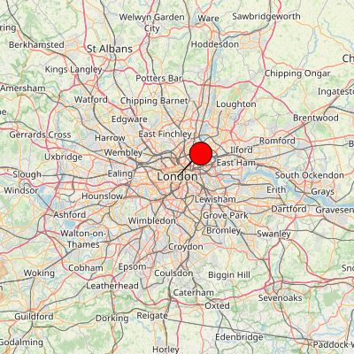
ImageEnView1.IEBitmap.GenerateMap( 400, 400, 51.50361, -0.12775, 9, iesmpOSM_Mapnik, true, 40, clRed );
// Save maps of major cities
type
TCityLocation = record
City: string;
Latitude: Double;
Longitude: Double;
end;
const
City_Locations: array[0..29] of TCityLocation = (
( City: 'London'; Latitude: 51.5036145; Longitude: -0.1277475 ),
( City: 'Rome'; Latitude: 41.9027835; Longitude: 12.4963655 ),
( City: 'New York'; Latitude: 40.7127753; Longitude: -74.0059728 ),
( City: 'Tokyo'; Latitude: 35.6761919; Longitude: 139.6503106 ),
( City: 'Wellington'; Latitude: -41.2864603; Longitude: 174.776236 ),
( City: 'Rio de Janeiro'; Latitude: -22.9068467; Longitude: -43.1728965 ),
( City: 'Cape Town'; Latitude: -33.9248685; Longitude: 18.4240553 ),
( City: 'Paris'; Latitude: 48.856614; Longitude: 2.3522219 ),
( City: 'Berlin'; Latitude: 52.520007; Longitude: 13.404954 ),
( City: 'Madrid'; Latitude: 40.4167754; Longitude: -3.7037902 ),
( City: 'Sydney'; Latitude: -33.8688197; Longitude: 151.2092955 ),
( City: 'Mumbai'; Latitude: 19.0759837; Longitude: 72.8776559 ),
( City: 'Dubai'; Latitude: 25.2048493; Longitude: 55.2707828 ),
( City: 'Singapore'; Latitude: 1.352083; Longitude: 103.819836 ),
( City: 'Hong Kong'; Latitude: 22.3193039; Longitude: 114.1693611 ),
( City: 'Beijing'; Latitude: 39.904211; Longitude: 116.407395 ),
( City: 'Moscow'; Latitude: 55.755826; Longitude: 37.6172999 ),
( City: 'Cairo'; Latitude: 30.0444196; Longitude: 31.2357116 ),
( City: 'Istanbul'; Latitude: 41.0082376; Longitude: 28.9783589 ),
( City: 'Los Angeles'; Latitude: 34.0522342; Longitude: -118.2436849 ),
( City: 'Toronto'; Latitude: 43.653226; Longitude: -79.3831843 ),
( City: 'Mexico City'; Latitude: 19.4326077; Longitude: -99.133208 ),
( City: 'Buenos Aires'; Latitude: -34.6036844; Longitude: -58.3815591 ),
( City: 'São Paulo'; Latitude: -23.5505199; Longitude: -46.6333094 ),
( City: 'Bangkok'; Latitude: 13.7563309; Longitude: 100.5017651 ),
( City: 'Seoul'; Latitude: 37.566535; Longitude: 126.9779692 ),
( City: 'Amsterdam'; Latitude: 52.3675734; Longitude: 4.9041389 ),
( City: 'Lagos'; Latitude: 6.5243793; Longitude: 3.3792057 ),
( City: 'Nairobi'; Latitude: -1.2920659; Longitude: 36.8219462 ),
( City: 'Vancouver'; Latitude: 49.2827291; Longitude: -123.1207375 ));
var
bmp: TIEBitmap;
i: Integer;
begin
bmp := TIEBitmap.Create();
for i := Low( City_Locations ) to High( City_Locations ) do
begin
bmp.GenerateMap( 600, 600, City_Locations[i].Latitude, City_Locations[i].Longitude, 6, iesmpOSM_Mapnik, False );
bmp.SaveToFile( format( 'D:\%s.png', [ City_Locations[i].City ]);
end;
bmp.Free();
end;